1. NOTICE IS HEREBY GIVEN by the Queen’s Harbour Master Portsmouth, that in order to bring in to service the widened and re-orientated Portsmouth Approach Channel, an updated Admiralty Chart 2625 (Approaches to Portsmouth) will be published by the United Kingdom Hydrographic Office (UKHO) on 2 March 2017, and that the navigation marks and port entry lights will be adjusted in the days immediately following, to reflect the characteristics, positions and directional light orientations shown on the chart.
2. This notice sets out the process by which these changes will take place, in order to assist the mariner in navigating safely within the approach channel throughout the transition period.
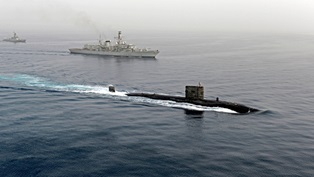
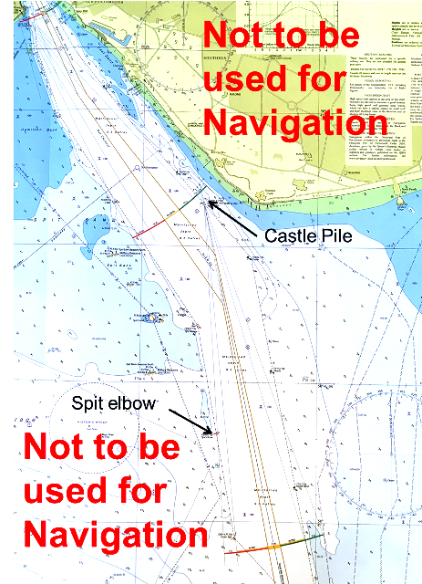
3. The most significant changes include a widening of the approach channel in preparation for the Queen Elizabeth Class carriers and a re-orientation of the channel such that the headmark for vessels entering past Outer Spit Buoy will change from Southsea Castle to a transit of the new ‘Castle Pile’ (50 46.67N 001 05.65W) with Southsea War Memorial.
4. On 2 March 2017, the new version of Admiralty Chart 2625 will be published. This will display the latest surveyed depths in and around the Approach Channel, as well as the planned positions, names, and characteristics for the Approach Channel lateral marks, the positions of new port entry lights and re-orientation of the Fort Blockhouse directional light. It will also include amends to the notes and the new position of the Small Boat Channel.
5. Over the following days, the workboat SD NAVIGATOR will move the channel lateral buoys to their new charted positions and change their light characteristics. This work is programmed to take approximately 4 days, although may take longer or shorter subject to weather conditions. A NAVWARN will be sent on the morning of 2 Mar 17, to notify mariners that the new chart has been published and to list the positions and characteristics of buoys and port entry lights at that time. Thereafter, the positions and characteristics of the buoys in place will be updated daily at approximately 1600 by NAVWARN, clearly stating which have been moved in accordance with the new chart, and which remain in their old position in accordance with the previous version or any associated correction or NAVWARN.
6. The majority of lateral marks will retain their current names and have relatively corresponding positions within the new channel as to the old one. However, Ridge buoy will be repositioned between Outer Spit Buoy and Spit Refuge, and be renamed Spit Elbow.
7. Once all lateral marks have been moved, the following changes to directional lights will take place:
a. The current directional port entry light on Fort Blockhouse will be switched off and a new one put in place, orientated to the new channel and with amended characteristics.
b. Southsea Castle directional and isophase lights will be switched off.
c. Castle Pile directional light will be switched on.
8. Once all changes have been made, a final NAVWARN will be published detailing the full list of characteristics. This will remain in force for a period of 12 weeks in order to provide sufficient and reasonable time for mariners and their chart providers to complete their updates.
9. The latest NAVWARNS and LNTMs will be published on the QHM website, www.royalnavy.mod.uk/qhm/portsmouth; users may subscribe to the mailing list in order to receive updates as they are published.
10. Cancel this LNTM 24 March 2017.
Friday 24 Feb 2017
S O Hopper
Queen's Harbour Master
Owners, Agents, Charterers, Marinas, Yacht Clubs and Recreational Sailing Organisations should ensure that the contents of this Notice are made known to the masters or persons in charge of their vessels or craft.